
Belgium country is the perfect hiking heaven. Hence it’s not at all surprising that two Belgian hiking networks were shortlisted for ‘ best hiking route of the year ‘ this year. It includes the 137 km long cross-border walk from Belgium to the Netherlands and back at the start. You can plan days or more walking trips. The whole path is full of exciting adventures, scenic beauty, elegant villages, meandering rivers, tropical greenery, unique animal breeds, demarcated residential areas, heritage, and many more. So, walkers wear your shoes, and head on to uncover the unknown of Belgium and the Netherlands.
This information will guide your 136km course:
Best Hiking Route Of The Year-Benelux
The best hiking cross border route is recognized by analyzing many perspectives. The 137 Kilometer extended and newly revived cross-border trail passes through eleven municipalities in Belgium and the Netherlands. In the east of the province, where the Meuse river meanders from Maastricht to Kessenich, you can explore the cross-border landscape.
Via bridges and ferries, you cross the Meuse River to the Netherlands and back. The maas forms you will uncover during the walk are the spectacular area with its bridges, picturesque townlets, ferries, winding river arms, and tropical leafage. You can kayak, sail, camp, go on a raft, enhance your heritage perceptions and go on hiking. You are free to decide and proceed with the route altogether and put together a multi-day expedition or else you can attempt a shortened version as per your choice in your very own Belgium.
RivierPark Maasvallei
The River Park Maasvallei takes you past the extensively gorgeous landscapes and alluring villages. The walk is voted ‘Best walking route in the Benelux’ in April 2021.
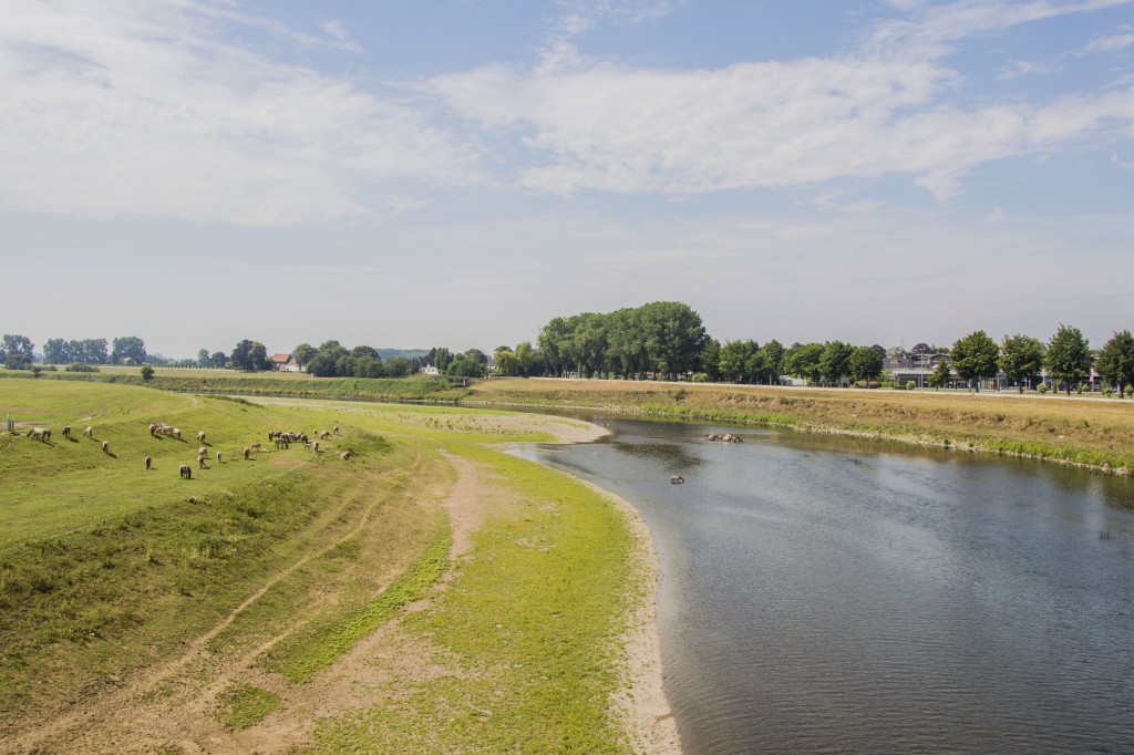
The Meuse is an impressive river mainly supplied by rainwater. It is the primary artery of Riverparc Maasvallei, molding the typical scenery. This river forms the border between Belgium and the Netherlands for a 40 km stretch from Maastricht in the Netherlands to Kessenich in Belgium. In the beds, plants and animals dwell, only found here.
Lots of water birds, butterflies, dragonflies, wild bees, and special flowers have found their homes here. Even the beaver will build its fortress again in this area. The Riverparc Maasvallei presents some typical Meuse villages, where time seems to have stopped. Like a threaded cable alongside the Meuse, each one of them radiates authenticity.
RivierPark Maasvallei has a diversified landscape with a quagmire of former distributaries, channels, and pebble banks, attached to a few well-demarcated residential areas. This is a distinctive area with numerous notable historic places. Come and experience essence and culture at RivierPark Maasvallei. So, put on your walking shoes and let yourself be enchanted by the curiosities during these marvelous village walks. You can explore this unique ecosystem on foot or bike.
Starting Point
Ready steady go…
So hikers, strollers, walkers let’s discover the unknowns of the best cross border of the year 2021. Are you planning to uncover the route yourself? You can start at various places, including parking P10 in Dilsen-Stokkem and the Maasstraat in Kinrooi. P10 De Wissen-Negenoord is considered the departure point of the beautiful walk. Stokkem is a Korver town with a wide culture.
This is the base for a hike in the Negenoord nature reserve, just opposite the Masscentrum. In this former gravel extraction area, nature has been given every opportunity, resulting in a beautiful patchwork quilt of thickets, ponds, riparian forests, and foraging nature. The mud watchtower in the area gives you a beautiful view of the region. You can watch the nodes and proceed. The path is simple and easy to walk and you can’t imagine the start is so stimulating and further, the great adventure awaits.
Bicycle
The best route of 137 km is a favourable path even for our enthusiastic bikers. Thanks to the substantial cycle street network in Belgium and the Netherlands, you can formulate your own cycle route on the source of nodes that are demonstrated in both directions. This way you determine which direction you prefer to go and how extended your ride is. During your bike ride, take a ferry to the other bank of the Maas. This makes cross-border cycling in the River Park Maasvallei very easy.
Via junction 49 in Dilsen or junction 50 in Meeswijk (ferry), you get on the cycle route network. You can park at Tugelaplein in Stokkem (P11, Tugelaplein) or scentrum De Wissen (P10, Negenoordlaan). You can map out your cycling route based on the cross-border themed cycling map RivierPark Maasvallei. More information about the route can be found on the website of RivierPark Maasvallei. So put the leg on the pedal and accelerate.
How do you identify a route?
The Long Distance Walk is signposted along its enormous length and in both directions with hexagonal, green plates bearing the RivierPark Maasvallei logo.
If you follow a particular symbol you will walk the route and eventually make your way back to the starting point. If you would like to blend two or more of the walking routes then take a hint of the route changes. These route changes mark the directions where walking routes correlate.
These junctions are numbered and specific on the route identifications and the maps. you first have to follow a short approach route that takes you to the fixed route of the Long Distance Walk. These approach routes are indicated by a hexagonal, white plate with the RivierPark Maasvallei logo on it. Shortening the route is always possible via the ferries and bridges over the Maas. To do this, follow the adjusted signage ( hexagonal, white pictures with ‘shortening ‘).
If you want to walk to another route changer, choose the colored symbol for that route changer and pursue it in the direction that you desire to go to enter the next route changer. The maps of the walking routes certainly demonstrate how and where you can change your route. This establishes many numerous route assortments in one extensive network that crosses the borders of different walking areas. It’s easy to note and follow so proceed.